Navigation
Contour interval and scale
How to read the scale and contour lines on a topographic hiking map — from 1:100 000 (planning) to 1:10 000 (orienteering). Distance, terrain and how much detail you actually see.
Contour lines and contour interval
The brown lines on the map are contour lines that show the difference in height in the terrain. The closer the lines are together, the steeper the terrain.
The contour interval tells you how much difference in height there is between each line. On a topographic hiking map at a scale of 1:50 000, the contour interval is 20 metres — which means that if you have moved from one contour line to the next, the difference in height is 20 metres. The more metres in the contour interval, the less detailed the map.
The contour interval is always stated on the map — check the margin.
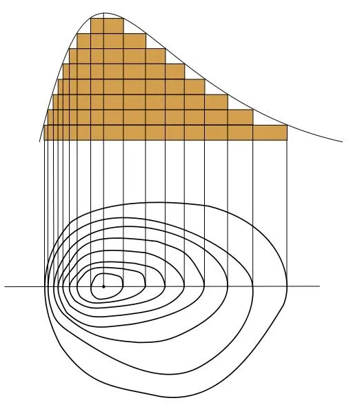
Illustration: Romary.
Scales — which one suits what?
| Scale | Distance in the terrain | Use | Information |
|---|---|---|---|
| 1:100 000 | 1 cm = 1 km | Planning | Little detail, hard to navigate by in broken terrain |
| 1:50 000 | 1 cm = 500 m, 2 cm = 1 km | Mountain hike | Common on topographic hiking maps. Smaller cliffs (10–15 m) often not visible |
| 1:25 000 | 1 cm = 250 m, 4 cm = 1 km | Local outing, day hike in the mountains | More and more topographic hiking maps use this. Good detail, but cumbersome on long trips (several maps) |
| 1:10 000 | 1 cm = 100 m, 10 cm = 1 km | Orienteering, short local outings | Common orienteering map, very detailed — shows boulders and cliffs |
Different maps with map base, scale and contour interval
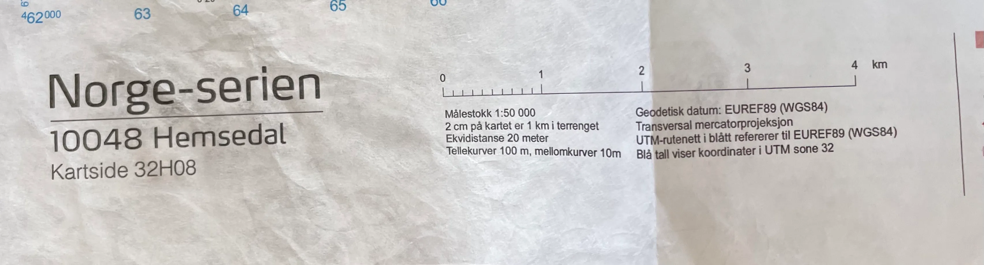
Nordeca, 2014, Norge-serien, turkart Hemsedal, 1:50 000 (Copyright Nordeca).
Turkart Svalbard, 1:50 000.
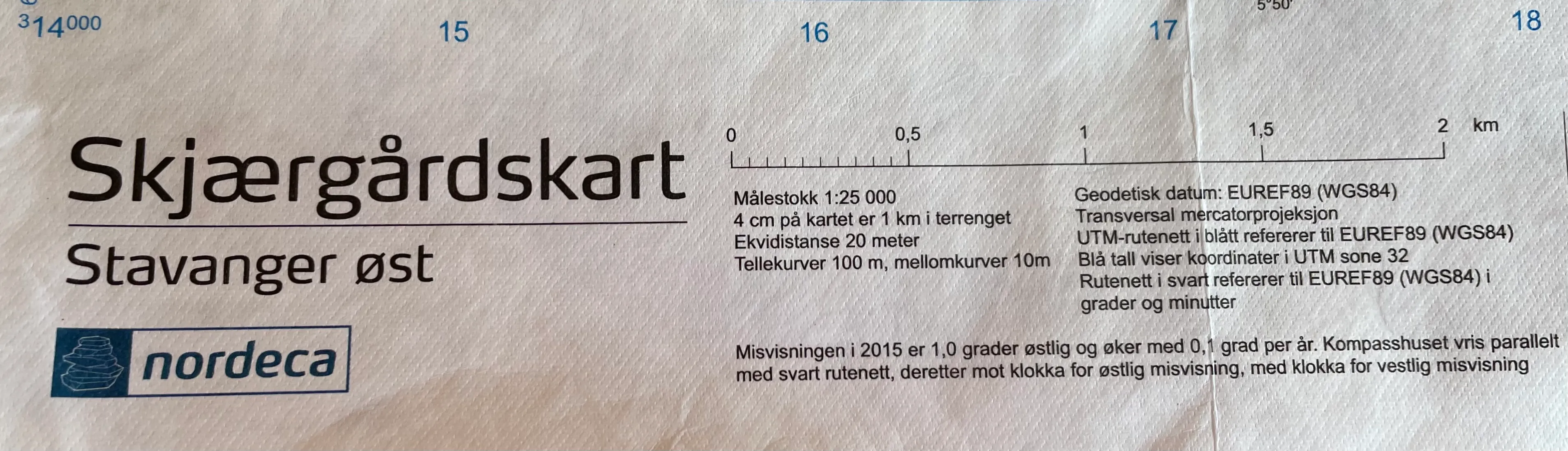
Nordeca, padlekart/nærmiljøturkart Stavanger, 1:25 000 (Copyright Nordeca).
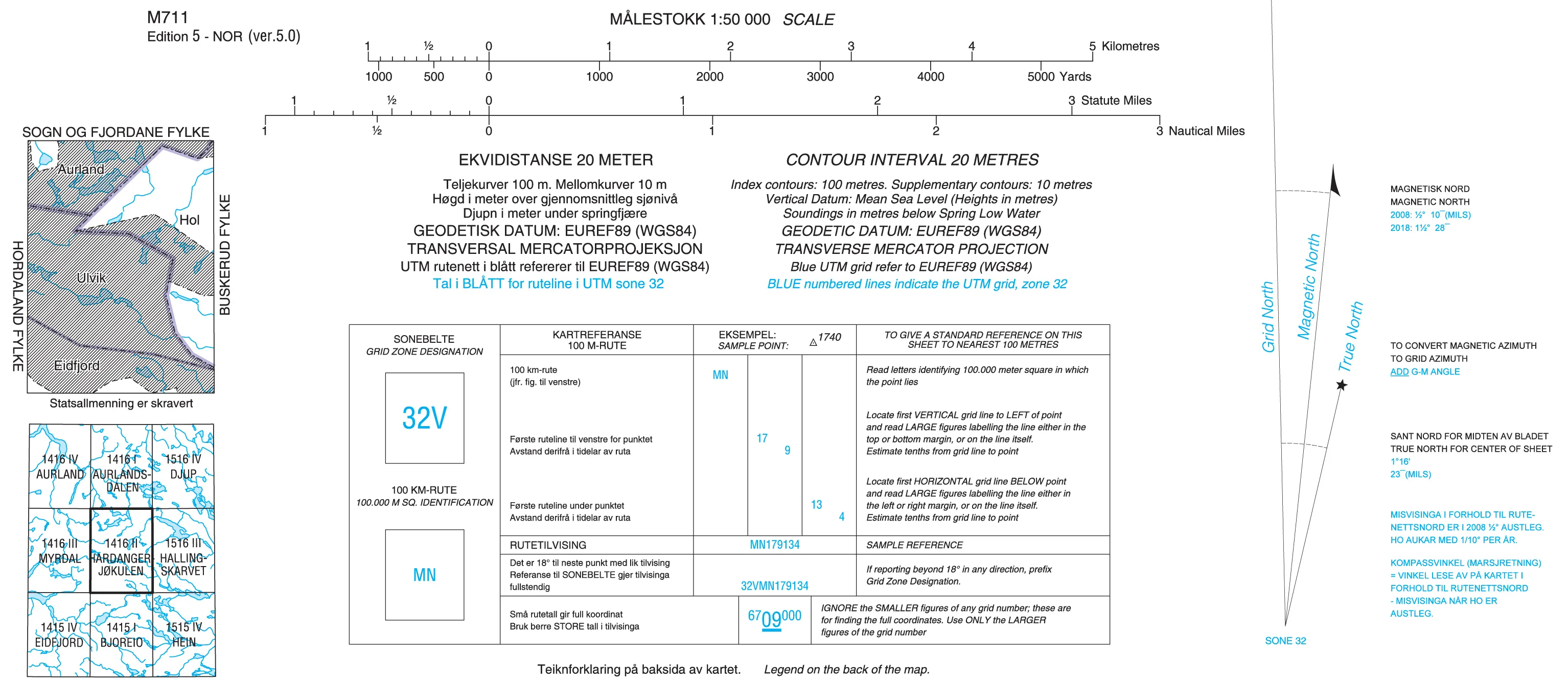
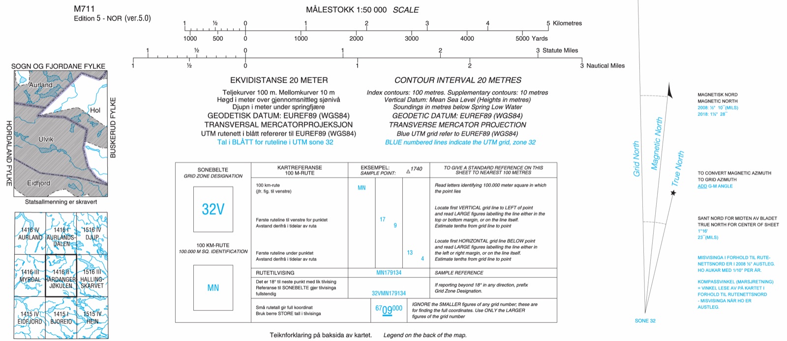
Statens kartverk, M711-serien, Hardangerjøkulen, 1:50 000 (Copyright Statens kartverk). NB! This map series is discontinued and can no longer be bought in shops.
Learn more about navigation
Compass course · Map reference · Magnetic variation · Cross-bearing · GPS · Printing maps from the web · Navigation at sea · Navigation by nature’s signs
Text: Gina Wigestrand, Snuitide (2021), revised 2026.
Sources: Kolbjørnsgard, S. (2021). Kart — ekvidistanse og målestokk [Video clip]. https://vimeo.com/736817567