Navigation
Cross-bearing
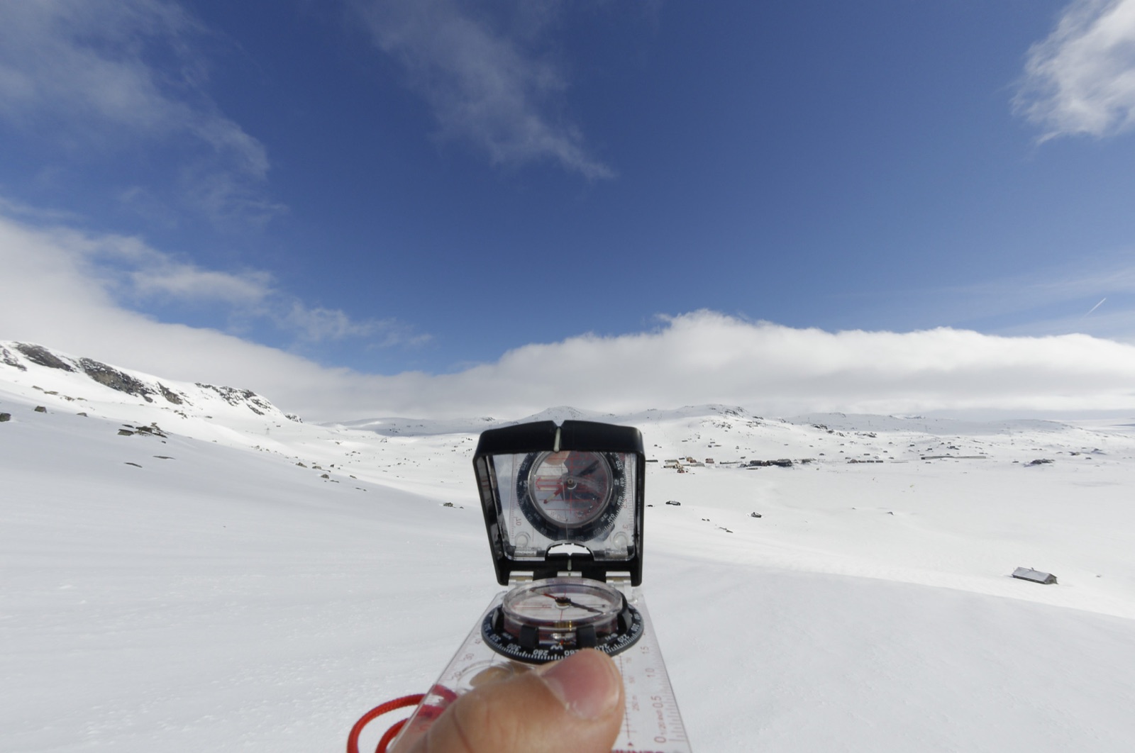
Cross-bearing is the technique for working out exactly where you are on the map — by taking a bearing on two or three known points with a compass. It requires that you have visibility.
If you have visibility, you can use a cross-bearing to fix your position on the map. A cross-bearing requires visibility — the method does not work in poor weather when you cannot see distinct terrain features around you.
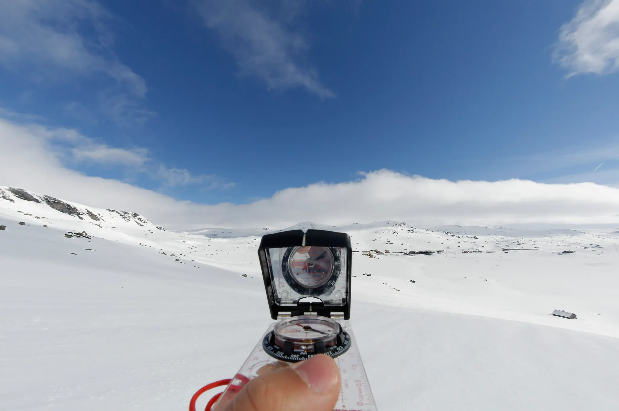
Photo: Ola Njå Bertelsen, Snuitide.
How to take a cross-bearing
-
Find a distinct terrain feature (knoll, summit, lake) that you can also recognise on the map.
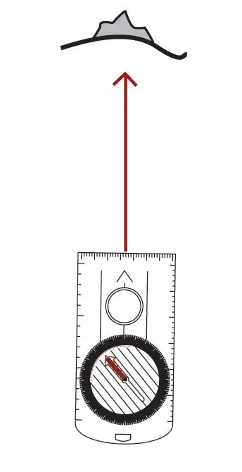
Illustration: K. N. Friis, Turlederboka, p. 74, Copyright 2010.
-
Sight with the direction-of-travel arrow on the compass towards the terrain feature, and turn the compass housing until the compass needle lies within the housing’s north arrow. You have now read off the compass bearing from where you stand to the terrain feature.
-
Correct for magnetic variation and draw the bearing as a straight line on the map, from the terrain feature back towards you. You are somewhere along this line.
-
Find a new point and repeat the process.
Sighting on a second summit that you can find on the map. You can also add a third point. Illustration: K. N. Friis, Turlederboka, p. 74, Copyright 2010.
-
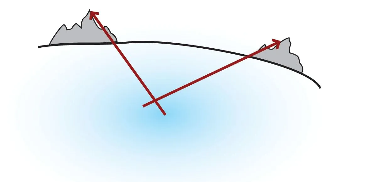
Your position is where the two lines cross each other.
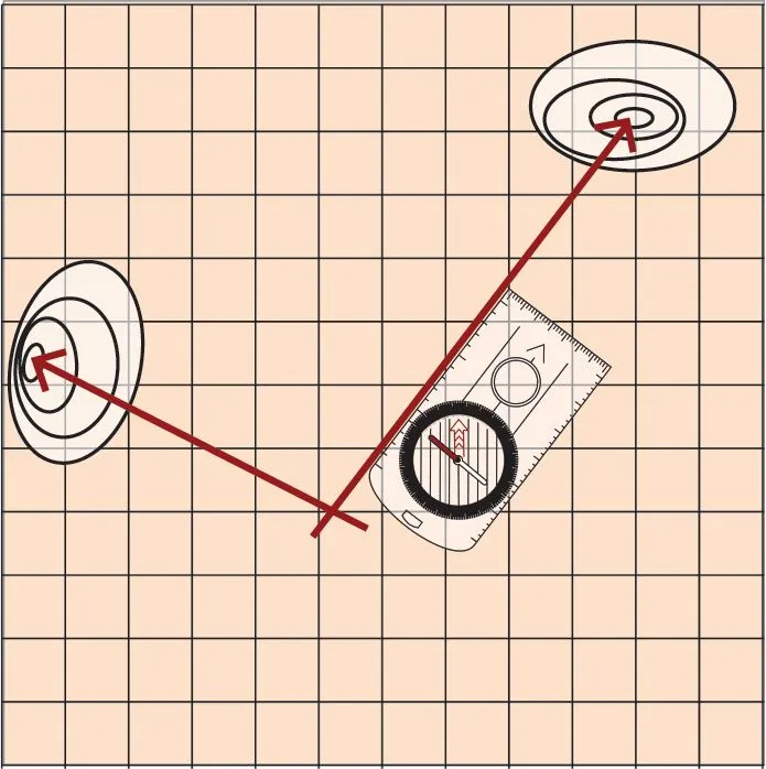
Draw the bearings you get onto the map. You are located where the lines form a cross. Illustration: K. N. Friis, Turlederboka, p. 74, Copyright 2010.
Tips for an accurate cross-bearing
- Choose features in different directions — the bearing is most accurate when the lines intersect at right angles (90°) (Unger, 2010).
- Take a third bearing as a check. The three lines will usually form a small triangle on the map. You are most likely located inside this triangle.
- Remember magnetic variation. If you forget to correct for it, the lines come out several degrees off — particularly noticeable in Western Norway.
- Use prominent points. A summit that is unambiguous, not one of several similar summits.
Learn more
Compass bearing · Magnetic variation · Map reference · Contour interval and scale · GPS · Navigating by natural signs
Text: Snuitide (2021), revised 2026.
Sources: Friis, K.N. (2010). In Blystad, J.T. (red.), Turlederboka (s. 74). Oslo: Den Norske Turistforening. · Unger, L.C. (2010). Orientering. In Blystad, J.T. (red.), Turlederboka (s. 67–83).