Navigation
GPS

GPS is a useful supplement to map and compass, but it does not replace them. Learn to use a GPS on a tur.
Contents
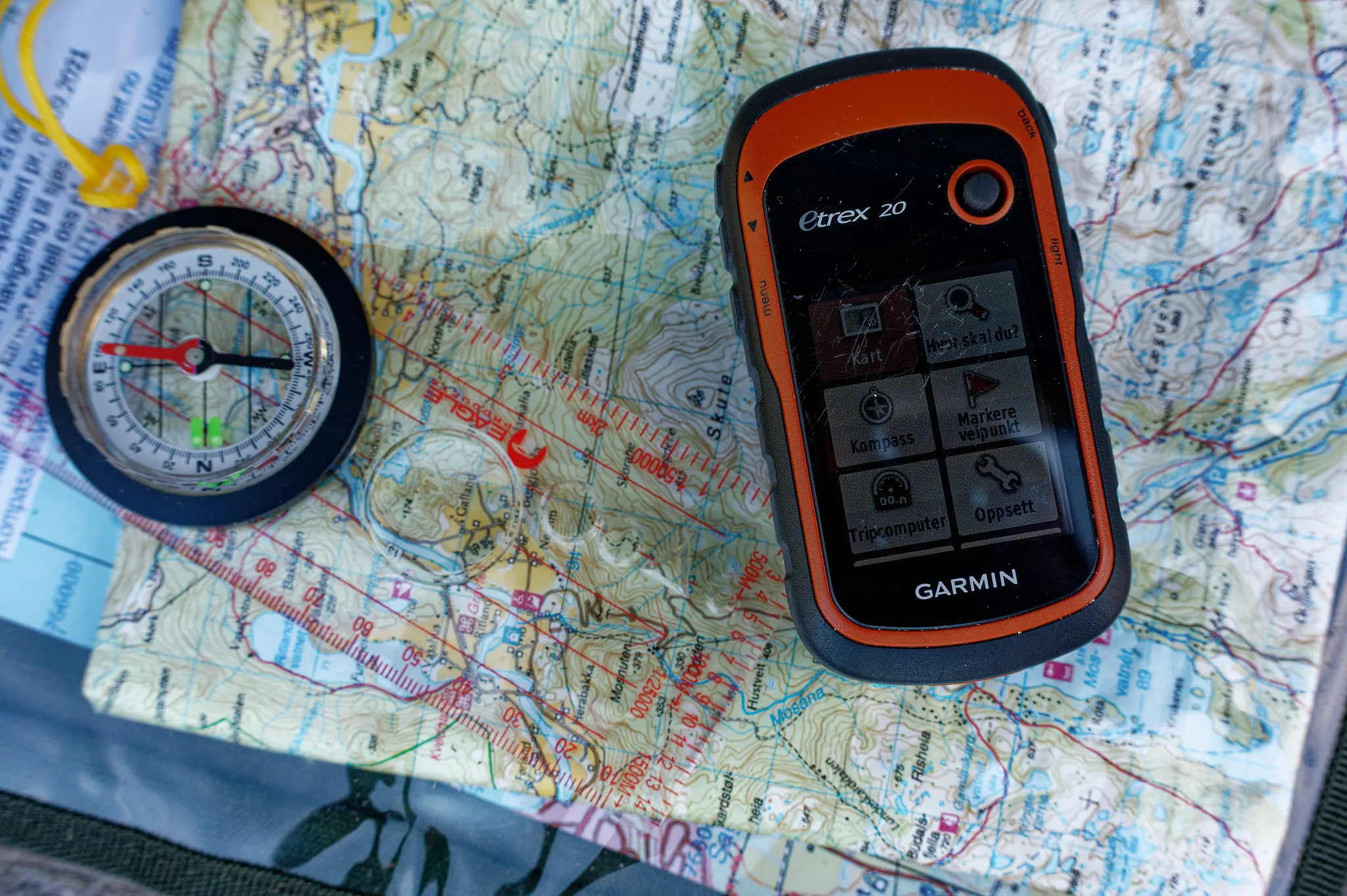
Photo: Ola Njå Bertelsen, Snuitide
GPS.
Today we have many good aids for finding our way. In town many people use GPS on their phone, and there are dedicated GPS units for outdoor use.
GPS is short for Global Positioning System. Satellites orbit the earth. The GPS receives signals from these and calculates the position we are at. When this position is placed on a digital map, we have a good aid for working out where we are and orienting ourselves in the terrain.
It is important to be aware that this technology can fail. The phone may run out of power, we may lack reception on the phone, or screens and buttons may work poorly in the cold. In some areas there is no satellite coverage. Typical places are narrow valleys. We must therefore always carry a map and compass and know how to use them.
Functions on the GPS
A GPS receiver receives information from GPS satellites that orbit the earth. To calculate an exact position it uses a three-point cross-bearing, which gives longitude and latitude. With contact with four or more satellites the elevation can also be calculated. If you are under cover or in places where the terrain blocks the view upwards, you can have trouble receiving signals from the satellites, and therefore have no position either.
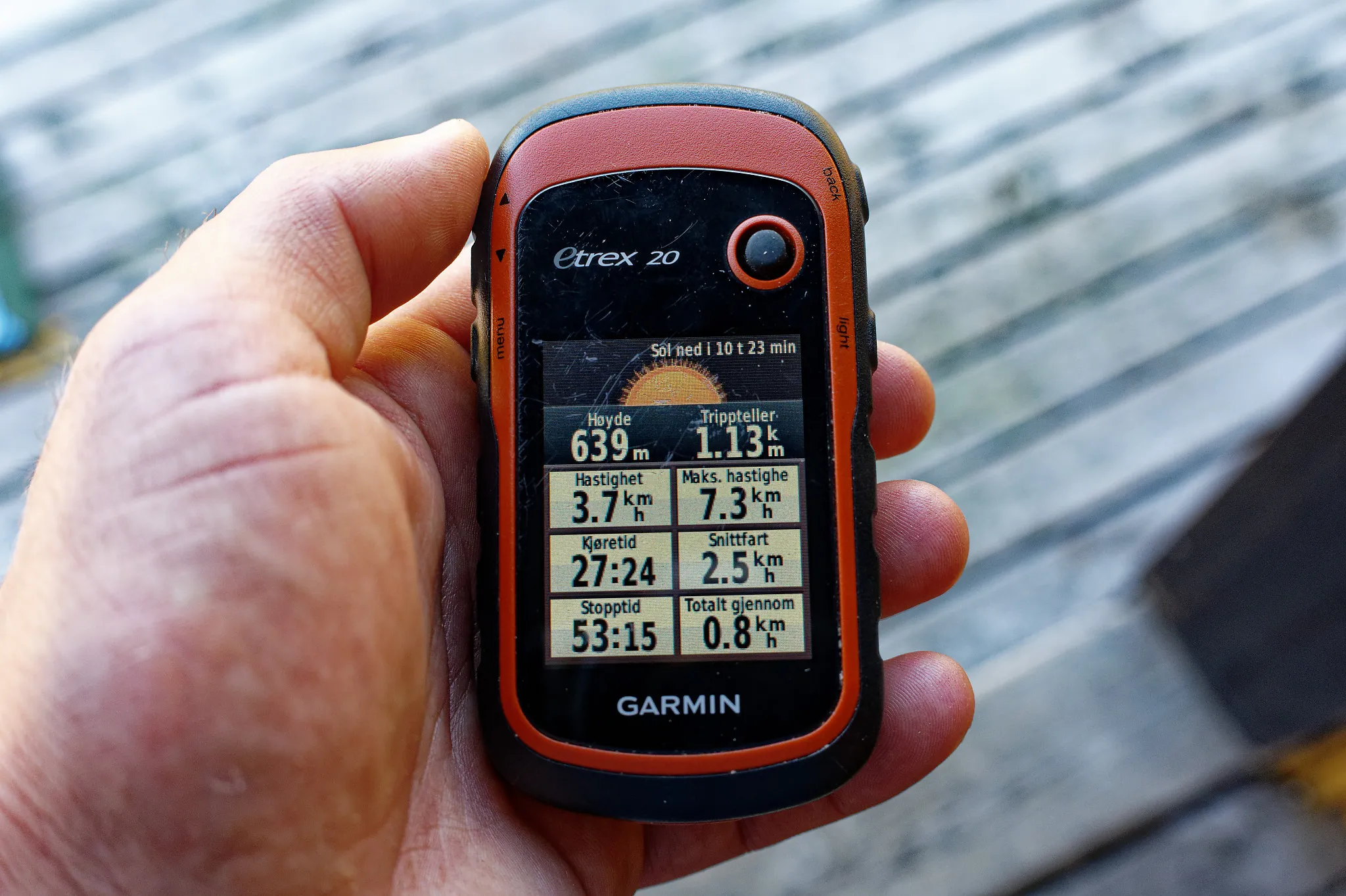
Photo: Ola Njå Bertelsen, Snuitide
GPS receivers are in a continuous process of improvement, and the ways they are used are also constantly changing. Today’s GPS receivers have equipment such as a barometric pressure sensor for calculating elevation or recording changes in the weather, and an electronic compass. The vast majority calculate speed, distance to the destination and estimated time of arrival, as well as ascent or descent time. Most GPS units today have a touch-sensitive screen. This gives a better user experience, but can be a challenge in the cold or when you have to use gloves.
Be aware that the more functions a GPS has, the more power it takes to run it. Several GPS units have the option of switching off individual functions to save power. You must always remember to bring spare batteries, and at lower temperatures the lifespan of the batteries drops. Do not rely on the GPS receiver alone; it is only a supplement to map and compass.
Position
The main function of a GPS is to give the coordinates of the position you are at. This universal function is a basic function on all GPS receivers, but certain preparations are nonetheless necessary. Always check that the GPS receiver you are using is set to the same geodetic datum as the grid on the map shows, since the GPS receiver can give your position relative to many different coordinate systems.
When you switch on the GPS receiver, it will usually take a few minutes before it picks up enough satellites; the first time in a new area it can take up to five minutes. The accuracy of the position you get on the GPS receiver depends on the number of satellites; with many satellites the accuracy is about one metre. The coordinates you get from the GPS receiver are then used to work out where you are on the map.
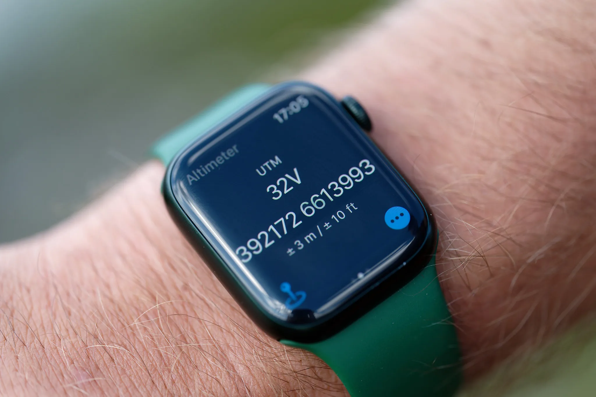
Photo: Gina Wigestrand
Waypoint function
In bad weather, the method of using GPS against the map can be a cumbersome way to navigate. Newer GPS receivers (without a map) are therefore fitted with a leg or waypoint function, where you enter in advance the route you are going to walk. A waypoint is a point with a given map reference, which you enter on the GPS receiver for each leg. By entering the route, you can be guided by the GPS receiver to the next point on the route. You then follow an arrow that continuously shows the direction towards the next waypoint. When you reach the marked point, the direction changes towards the next point. You can yourself change how close to the point itself you have to be for the GPS receiver to switch to the next one. It is important to note that the GPS receiver does not lead you around cliffs, ledges and the like.
Track function
The vast majority of newer GPS receivers have a function that lets you save the route you have walked, a so-called track function. This can be useful in bad weather and in exposed places, where you want to follow the same way there and back. You must specify how often the GPS should mark the points, and this will depend on the GPS’s memory.
Map on the GPS
The screens on GPS units are getting steadily better, with colour, light, higher resolution and touchscreen. The vast majority of smartphones also have a built-in GPS receiver, and together with a map application it can function almost as a fully fledged GPS. Orienting with a map on the GPS receiver has become possible. After loading the map you are going to use, you choose the scale yourself and how many details should be shown. The map follows the user’s position the whole time. In theory this is a very good aid for navigation in the mountains, but the GPS receiver should only be a supplement to navigation with map and compass. The electronics and the batteries may stop working in extreme weather conditions. Using GPS can lead to reduced traditional navigation skills with map and compass. GPS is not a necessity on a tur, but a good supplement that can provide extra reassurance in bad weather.
Next steps
- Navigation — the hub
- Digital tools in trip planning — other digital resources
- Map and compass — exercises — practise the map fundamentals
- Navigating by nature’s signs — backup when the GPS fails
Learn more
- Kartverket — map base and symbols
- Norgeskart — interactive map
- Norges Orienteringsforbund — sport and courses
- UT.no — route data