Navigation
Magnetic variation

The difference between the map's north and the compass needle's north. How to correct for magnetic variation when taking a compass bearing — especially important in Troms, Finnmark and on Svalbard.
The grid in the UTM system on the map points neither quite to magnetic north nor to geographic north. The compass needle in the compass points to the magnetic North Pole. Magnetic variation is the difference between grid north and magnetic north (Unger, 2010).
If you want to take a very accurate compass bearing, you have to account for the magnetic variation (in degrees). The magnetic variation is always given on the hiking map (turkart) — note that it changes over time.
The magnetic variation varies depending on where you are in Norway — from about 11 degrees east variation in eastern Finnmark to about 3 degrees west variation in western Norway (Statens kartverk, the Norwegian Mapping Authority, 2021).
In many places the magnetic variation is so small that you do not need to account for it. In Troms, Finnmark and on Svalbard, by contrast, the magnetic variation is so large that correcting for it when you take a bearing is absolutely essential.
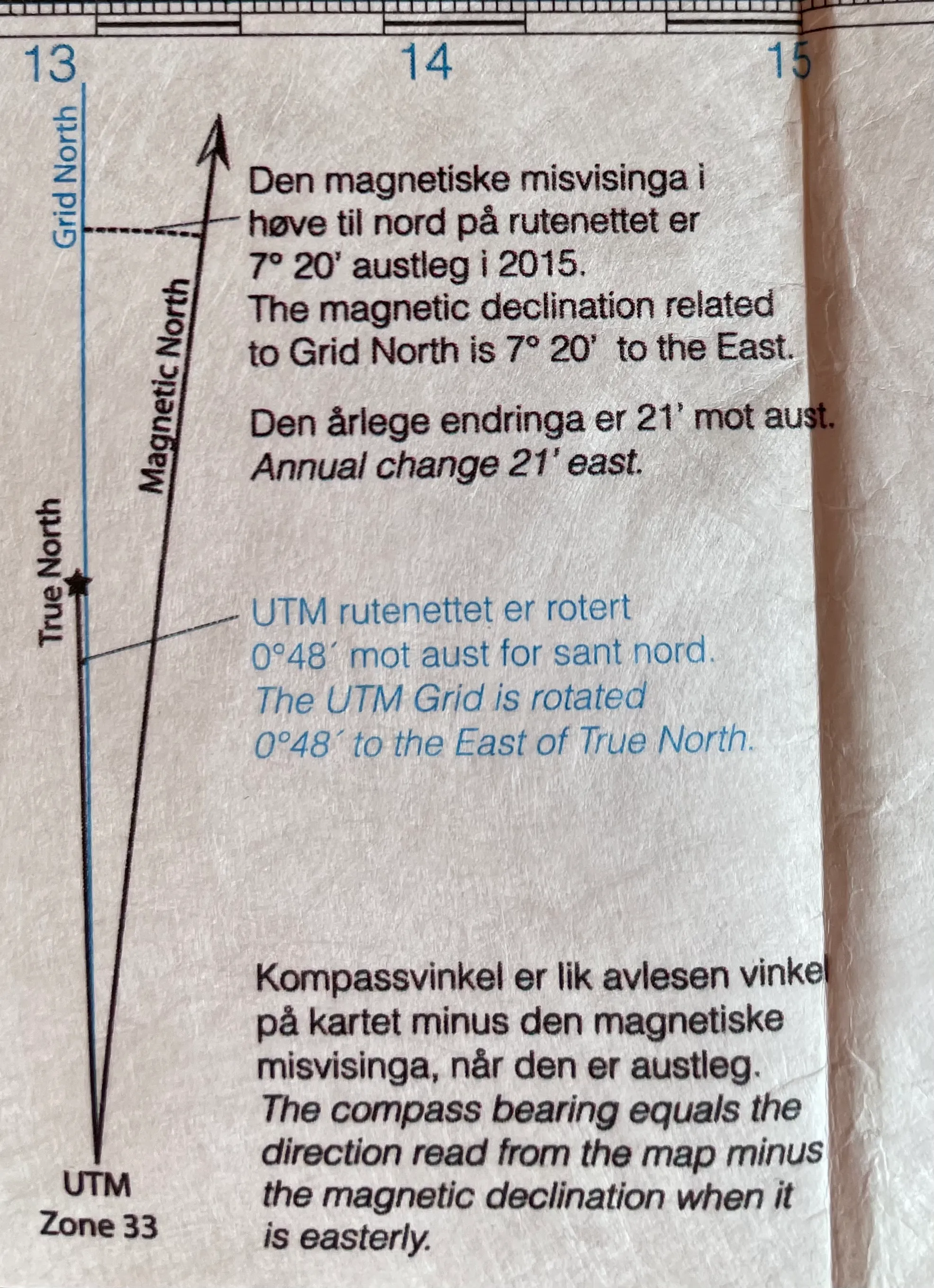
Example of magnetic variation on a map of Svalbard. The variation was 7 degrees east in 2015. NB! In 2021 the magnetic variation on Svalbard is 9 degrees east. Photo: Gina Wigestrand.
Correcting a bearing for magnetic variation
For west variation you add the number of degrees given for the variation. For east variation you subtract.
You always correct the bearing after it has been taken off the map, and before you find a point in the terrain.
For cross-bearing, where you transfer the bearing to the map, you have to adjust the other way. You then correct the bearing by adjusting to the right if the variation is west, or to the left if the correction for the variation is east.
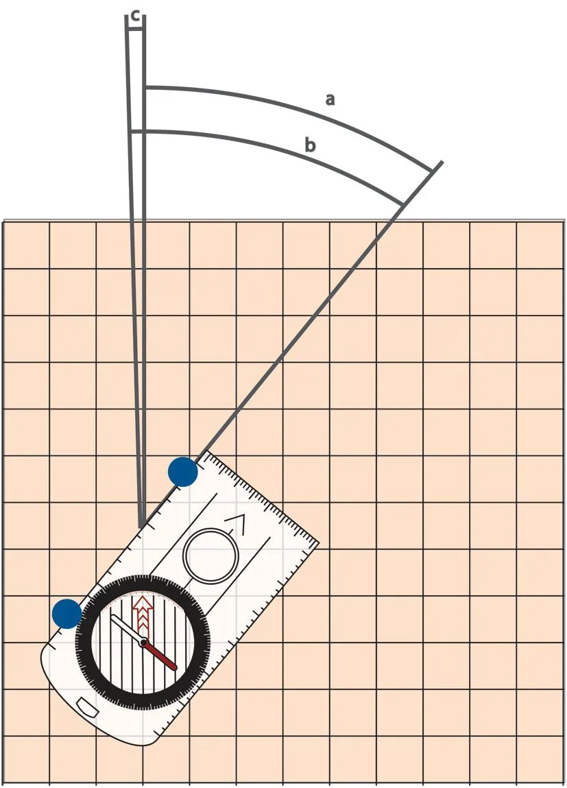
a — shows the original bearing (43 degrees). b — shows the bearing corrected for magnetic variation (40 degrees). c — shows the difference between magnetic north and geographic north (3 degrees west). Illustration: K. N. Friis, Turlederboka, p. 73.
Work out the magnetic variation for your area
Statens kartverk (the Norwegian Mapping Authority) has an up-to-date calculator: Magnetisk misvisning →
Learn more
Compass bearing · Cross-bearing · Map reference · Contour interval and scale · GPS · Navigation at sea · Navigation by nature’s signs
Text: Lars Christian Unger, Turlederboka (2010), adapted by Gina Wigestrand, Snuitide (2022).
Sources: Blystad, J.T. (red.) (2010). Turlederboka. Oslo: Den Norske Turistforening. · Friis, K.N. (2010). Figur 7.4 A og 7.4 B. I Blystad, J.T. (red.), Turlederboka (s. 73). Den Norske Turistforening. · Unger, L.C. (2010). Orientering. I Blystad, J.T. (red.), Turlederboka (s. 67–83). Oslo: Den Norske Turistforening. · Statens kartverk (2021). Magnetisk misvisning.