Navigation
Ridge
Map symbol for a ridge (fjellrygg): clear contour lines in a U shape. Paths are often laid along the ridges — easier to follow than a ravine, and easier to navigate from.
Ridges are usually clear and distinct on the map. Paths are often laid along the ridges — it is easier to follow the ridge than to be down in a ravine, and it is easier to navigate on top of a ridge because you have a view of the surroundings on both sides.
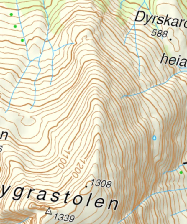
A clear ridge formation in Rosendal. Map: screenshot from norgeskart.no.
In the terrain you recognise a ridge by the contour lines forming U-shaped patterns with the point pointing away from the summit.
Another example: a less steep ridge where the path runs from west to east.
More map symbols
Mountain summit · Contour lines · Valley · Cliffs · Ravine, gap, stream valley